CLIENT:
PKPL Project, 24 ECBDE, Bangladesh Army
The Bangladesh Army (24 Engineer Construction Battalion - ECB) has undertaken a project aimed at optimizing the safe transportation of Jet A-1 fuel to the Kurmitola Aviation Depot (KAD). DSGS conducted a detailed bathymetric survey and hydrological Modelling in Sitalakhya River near Pitalganj Depot.
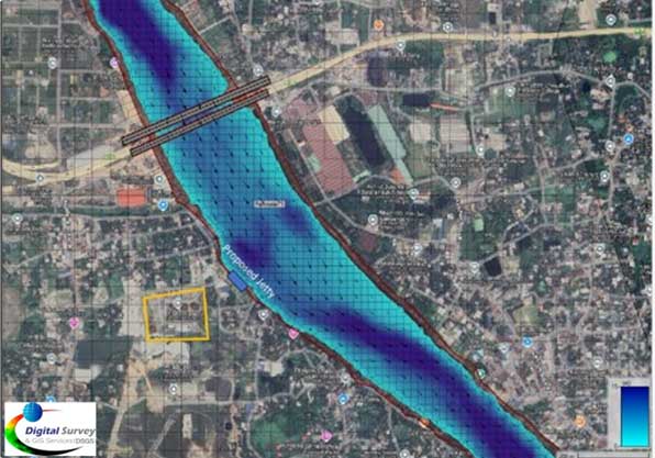
A detailed bathymetric survey was carried out over a 12-kilometer stretch of the Shitalakhya River in the vicinity of the proposed jetty site. The survey included 190 cross-sections. Within the critical 2-kilometer zone surrounding the jetty, high-density measurements were taken at 20-meter intervals to accurately capture riverbed features. For the upstream and downstream areas beyond this core zone, a lower measurement density (at 100 to 200-meter intervals) was applied. The primary objective of the survey was to develop an accurate riverbed profile to support dredging plans and the engineering design of the jetty.
A comprehensive two-dimensional hydrodynamic modeling study was undertaken to assess both current and projected flow conditions around the project site. The analysis included bed-level variation assessments and simulations under various hydrological scenarios, including low flow, average flood, and extreme flood events. The results have been documented in the Final Report, serving as a key reference for decision-making regarding the proposed jetty location.
Map showing Shitalakshya River along with jetty location
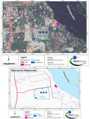
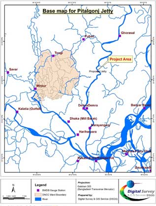
Base Map of the Study Area
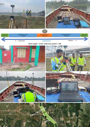
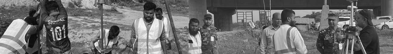
A comprehensive bathymetric survey was conducted by boat
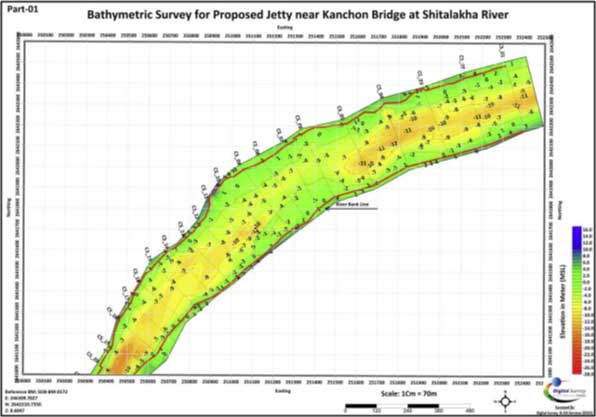
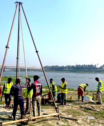
Bathymetric Survey for Proposed Jetty near Kanchon Bridge at Shitalakha River